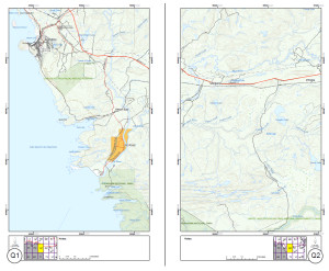
 “An aboriginal society must specify the area that has been continuously used and occupied…the aboriginal right of possession is based on the continued occupation and use of traditional tribal lands since the assertion of Crown sovereignty.” – a quote from the Supreme Court of Canada’s Delgamuukw decision (1997). Recognizing this, the Pic River First Nation Lands and Environment office wanted to give its members a set of maps to support their continued use and exploration of the Territory. Working with PlanLab, a 60 page Territory Map Book was created, illustrating logging roads and access routes at a scale of 1:75,000. The books were handed out during Pic’s Aboriginal Day celebrations over the weekend. And what a celebration it was.